The Ebbetts Pass National Scenic Byway is one of only seven nationally designated byways in California and 151 in the nation.
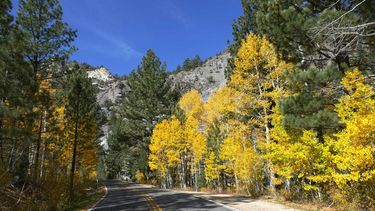
This beautiful road juts up from the heart of the Sierra Nevada with Lake Tahoe and Yosemite National Park as its neighbors, the byway is a 61-mile stretch of Highways 4 and 89, in between the towns of Arnold in Calaveras County and Markleeville in Alpine County, California.
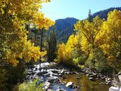
Glacially carved valleys, granite outcroppings, basalt columns, ancient volcanic peaks, deep river canyons, thick forests, bald eagles, majestic stands of Giant Sequoia, open meadows, pristine alpine lakes, precarious drop-offs, small
hamlets, warm hospitality, hot mineral pools, swiftly flowing streams, cascades and rivers, and some of the most dramatic and breathtaking views of the Sierra Nevada mountain range—these are just a few of the natural wonders awaiting you as you travel the Ebbetts Pass National Scenic Byway.
Ebbetts Pass is a vital link to spectacular Central Sierra attractions, including two state parks—
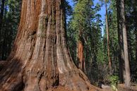
Calaveras Big Trees State Park (featuring the northernmost of the giant sequoia groves) and Grover Hot Springs State Park—as its “bookends,” the nationally-recognized Pacific Crest Trail, the Stanislaus and Humboldt-Toiyabe National Forests, the Carson-Iceberg and Mokelumne Wilderness areas, the North Fork of the Stanislaus, Mokelumne and East Fork of the Carson rivers, and Bear Valley cross country and downhill ski areas. With a range in elevation from approximately 4,000 to 8,700- feet, this winding mountain pass through the “California Alps” in their most natural state allows visitors the awe-inspiring experience of having the threshold of the Sierra literally at their feet.
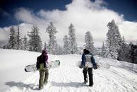
The driving experience on the Ebbetts Pass National Scenic Byway is like no other, providing an exceptional and intimate high country experience. As most of the byway is surrounded by national forest and wilderness areas, recreational opportunities are the mainstay of the Ebbetts Pass region with hiking, backpacking, camping, biking, kayaking, canoeing, fishing and swimming during the warmer months, and cross-country and downhill skiing, snowboarding, snowshoeing, sledding and snowmobiling in the winter.
Unlike any other Sierra pass, it is silver that built Ebbetts Pass. With the discovery of gold on the western slope of the Sierra Nevada, Native American trails were transformed into dirt roads by fortune seekers heading west. In 1861 the route reversed direction and became a booming toll road transporting silver miners to the east side Comstock Lode. Calaveras Big Trees was also a main attraction early on and continues to be one of California’s most sought out destinations. Ebbetts Pass, first surveyed in the 1850s as a possible railroad crossing for the Atlantic and Pacific Railroad Company, is one of the oldest trans-Sierra routes with many rich stories. The national conservation movement gained strength when John Muir visited Big Trees, and became outraged after witnessing the stump of a behemoth Giant Sequoia that had been felled and its bark stripped and taken on a tour as a traveling exhibit.
The Ebbetts Pass Scenic Byway Association’s website includes a page each on the following points of interest, listed from westernmost to easternmost:
Videos and blogs featuring the Ebbetts Pass National Scenic Byway: Fall Colors | Calaveras Backroads and Byways – Some of Our Best Little Secrets
Get a video introduction from Sandi Pearce in the video below

